Cape Palliser in New Zealand is one of the most notable landscapes in North Island. The wild area offers black beaches, a large seal colony and the unique Cape Palliser lighthouse with its stripes. Below is my guide to help you plan your visit to the Palliser Bay.
Why visit Cape Palliser in Wairapapa?
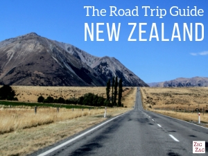
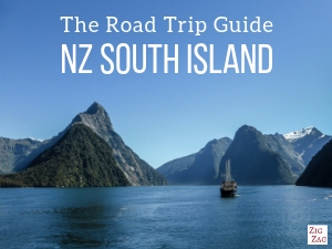
The road to Cape Palliser, on the South coast of North Island, is one of the most beautiful drives in the country.
The landscape is very scenic with mountains dropping into turquoise water. And with black sand beaches in the middle!
Below is a photo taken from the lighthouse that it worth a thousand words in my opinion…

You can now probably understand why it is one of my favorite landscapes in New Zealand and one of the best places to visit in North Island (see my list).
Video of Cape Palliser
Below is a short video of the area including the drive to Cape Palliser, the beaches, the climb to the lighthouse and a quick look at the seals:
About the name Palliser
In 1770 Captain Cook named the south-easternmost promontory “Palliser” in honour of his friend, Sir Hugh Palliser.
More photos after the practical information.
Planning tips – Cape Palliser New Zealand
How to get to Cape Palliser
- South coast of North Island, East of Wellington – in the Wairapapa region
- South of Martinborough – Turn at Lake Ferry
- Martinborough to Cape Palliser = 1h drive
- Wellington to Cape Palliser = 2h10 drive – so it can be a great day trip from Wellington
- You can find the cape with the Putangirua pinnacles in my travel guide ebooks, with GPS coordinates and practical maps to simplify the planning of your NZ road trip:
Plan your dream trip to New Zealand with my guides!
- 12 easy-to-plan maps
- 200+ pre-selected locations
- GPS coordinates
- Useful planning tips
- 285+ large photos
- 6 easy-to-plan maps
- 110+ pre-selected locations
- GPS coordinates
- Useful planning tips
- 190+ large photos
Visiting Cape Palliser
- The scenic drive from the Putangirua carpark to Cape Palliser is a 30min drive
- Note that there are no gaz station, so fuel up before visiting
- The last 3km to the lighthouse carpark are on a gravel road
- Toilets at the lighthouse carpark but none at the beaches
- 252 stairs to the lighthouse lookout platform
- It can be very windy, so bring layers of clothes
Need to rent a car in New Zealand?
My tips:
- Compare prices on my favorite platform: Discovercars.com – one of the best rated comparison sites!
- Prefer a car with enough power for the mountain areas
- Consider their full coverage option – it for peace of mind!
- Book early to have a large choice of vehicles!
- See all my tips to choose and book your car


Cape Palliser accommodations
- There are not many options close to the Cape. You can find a few in the small town of Ngawi – See options
- Otherwise you can find a lot of great places to stay in Martinborough surrounded by vineyards. It is a beautiful, relaxed little town
– Check out the best rated accommodations - I personally stayed at the Martinborough Experience B&B – the owner was charming and the decor was too – it is another one of my favorite stays in New Zealand
– check out more photos and availability

Cape Palliser Road – A scenic drive along Palliser Bay
I know that the highlight of Cape Palliser is the lighthouse. But I thouroughly enjoyed the drive the get there.
I had just finished my 3 hour walk around the Putangirua pinnacles and New Zealand wanted to keep blowing me away 🙂
At the beginning, the road is cut right by the water. The white cliffs drop into the turquoise water. The work of erosion and the colors are mesmerizing (especially with a blue sky).

Then, the cliffs are less abrupt. You can see hills of volcanic soil gently ending onto black sand beaches.
There is little vegetation and the shapes are fascinating.
The whole drive is along the shore.


The last 3km of the drive to Cape Pallier are on a gravel road. There is only one difficult place (picture below).
The road is only one lane and there is a sharp bend around the cliff. Slow down and use the mirror.

It is not that easy to stop but as soon as you see some space, I recommend doing so. The views are captivating and the rocks are too.

The rest of the gravel road is not difficult: wide and in good condition.

And then you see the lighthouse appear…

Cape Palliser geology
Fans of geology and rock formations will have a blast.
There is of course the Putangirua Pinnacles at the beginning of the drive.
But even if you can’t do that walk, there is much to see. Let me share with you a little bit of information I have found:
- On part of the shore, you can see uplifted marine terraces from the Pleistocene
- The lighthouse is built on a cliff of volcanic rock. It is believed to have erupted underwater 100 million years ago.
- By the water, you can see black sand/pebble beaches made from volcanic rocks
- The mountain ranges are Rimutaka and Aorangi

Cape Palliser beaches
Below are a few pictures of the beaches you can see along the drive.
The dark pebbles contrast with the turquoise of the water.


I think these are some of the most beautiful beaches in New Zealand… at least for photographers

Cape Palliser fishing
Cape Palliser is know for its fishing. There is a wide range of species found in the Palliser bay with red and blue cods, blue mokie and many more…
You can take a boat from Ngawi or simply fish from the shore, like the man in the picture below:

I don’t drink coffee 

But I also like other drinks and sweets!
Do you like the free content you find on my blog? All my tips and practical information, without intrusive advertising…

Cape Palliser Lighthouse & view of Palliser Bay
And then you reach the lighthouse (or you can stop to see the seals before – see next section).
Lighthouse carpark
There is a large carpark. You can’t miss it, it is at the end of the road…
You will find toilets at the Cape Palliser lighthouse carpark.

Staircase to the lighthouse lookout at Cape Palliser
Then you get ready to climb…
I counted 252 stairs to reach the top. But they are quite small and very regular. SO it is not as difficult as it seems. The hardest part is that the staircase is not wide, so it is not so easy to cross path with people going the opposite way.


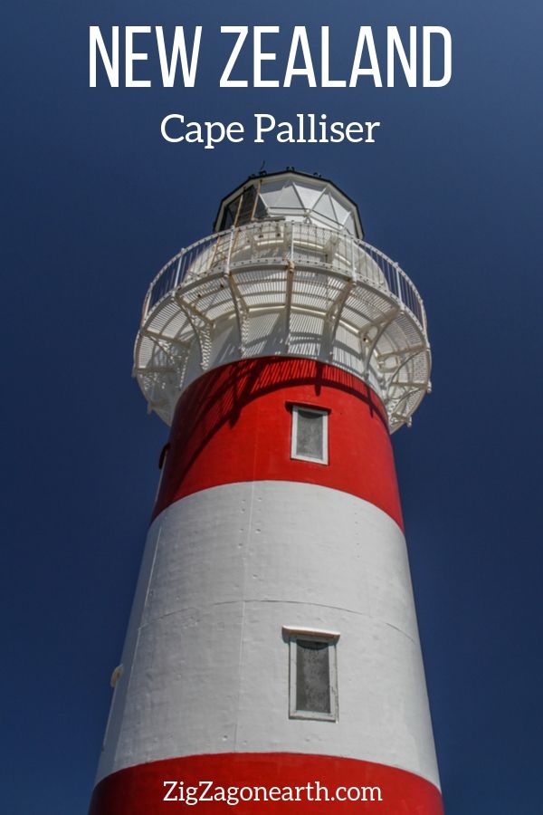
The Cape Palliser Lighthouse – Facts
- Originally built in Birmingham, UK and shipped in pieces
- Assembled in 1897
- The oil lamp was replaced for an electric version in 1954
- It was automated in 1986 and it controlled from Wellington.
- The volcanic cliff on which the lighthouse was built is 58m hight (190ft).
- The staircase was first installed in 1912 as the climb was treacherous
- It has a special painting scheme with colored stripes of red and white. It is unique in New Zealand. Therefore it is easy to recognise (there are only 2 other striped lighthouses in NZ and they are black and white)
- Despite the presence of this very useful lighthouse, there are around 20 shipwrecks in the area because of the treacherous underwater land.

Cape Palliser lookout
You cannot enter the lighthouse. But the best part in my opinion is the view from the lighthouse platform (at the bottom of it).
You have expansive view over the Palliser bay, the hills and the Cooks’ Straight.

The hardest part for me was walking down, as I suffer a little from vertigo. I went very slowly and all was good!
Once again: worth it!

Cape Palliser waterfall
From that carpark there is a walk through a gate. It takes over 1h to reach a waterfall.
I have not done it.
Cape Palliser Seal Colony – Matakitaki-a-kupe Reserve
Before reaching the lighthouse carpark, you may notice a carpark on the sea side.
It is the Matakitaki-a-kupe Reserve.
Drive slowly!
It is home to a seal colony, the largest in North Island.
Stop, get out of the car and look on the rocks below.


These seals are New Zealand Fur Seals
- They have external ears
- Their body is covered with 2 layers of fur
- They have a point nose
- Their breeding season is from mid-November to mid-January

Note that if you see one lying not far from you, don’t get closer. Always leave a few meters of distance.
Settlements and the fishing village of Ngawi
Maori history at Palliser Bay
Archeologists say that Maori people have settled here in the 1300s.
It seems that they were driven away by the climate change.
Temperatures seem to have dropped and the area abandoned between 1600 and 1850.
Theories say that maybe a tsunami caused the damage. But many say that humans were responsible for the disappearance of the forest. Learn more

Nowadays
You can see 2 settlements along the Palliser Bay:
- Close to Cape Palliser is the smallest one Mangatoetoe
- 10min drive from the lighthouse is Ngawi
Ngawi is a small fishing village.
It has a few accommodations and a campsite.
I have lost my picture of them, but you will be surprise by the large number of bulldozers. It is because they are used to take fishing boats in and out of the water.
Cape Palliser Pinnacles – Putangirua
As I said earlier, on the way to Cape Palliser, you can stop at another highlight of the region: the Putangirua Pinnacles.
The walk is at least 2h or 3 or 4h (depending on which loop you complete).
It was a filming location of Lord of the Ring.
Photos and practical tips on my article on the Cape Palliser pinnacles

Accommodations in the Cape Palliser region
As mentioned earlier, there are only a few accommodations near the Cape.
I recommend that you spend the night in the wine town of Martinborough.
There is a good choice of charming B&Bs – See the best rated options


I personally stayed at the Martinborough Experience B&B – the owner was charming and the decor was too – it is another one of my favorite stays in New Zealand – check out more photos and availability
Want to see more of NEW ZEALAND?
PREVIOUS:
Putangirua Pinnacles Walk New Zealand
NEXT:

Fascinating scenery, isn’t it?


